
Writer : Lutfiah Nur Rohmah Salaamah
Editor : Mely Anggrini
Translator : Aisyah Nurdiva Dewary Priatna
Friday, March 22nd 2024
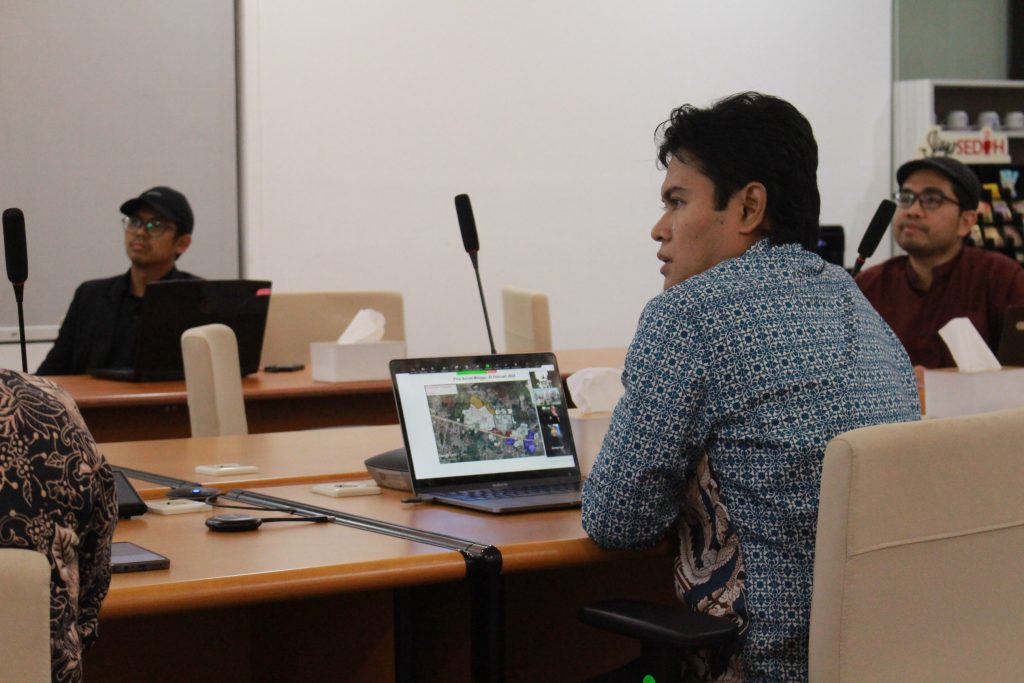
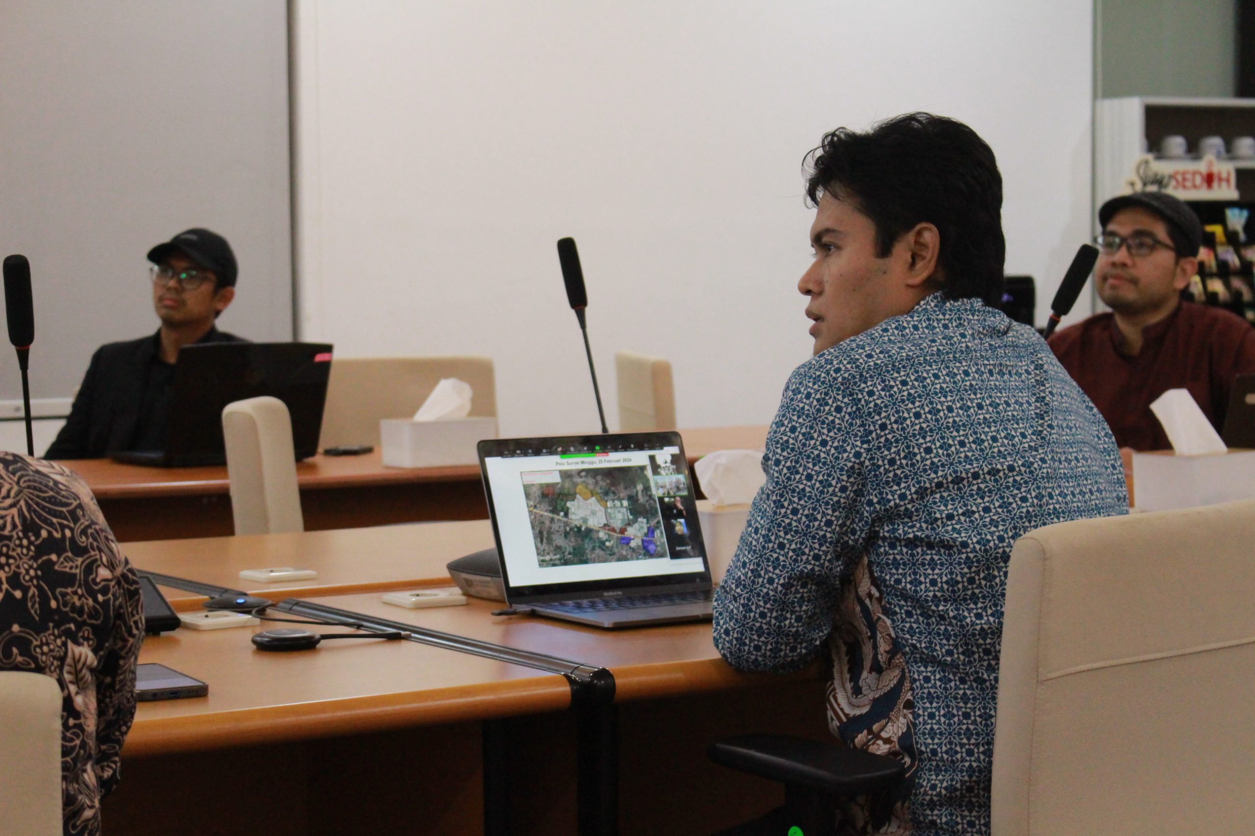
BANDUNG, meteo.itb.ac.id — The ITB Meteorology Study Program hosted a webinar regarding the tornado that struck Rancaekek on February 21, 2024. The event was led by Dr. Nurjanna Joko Trilaksono, S.Si., M.Si., from the Atmospheric Science Research Group, an expert in the study of the mesosphere and tornadoes. The webinar saw significant participation, attended by faculty members and 75 participants from diverse backgrounds, including representatives from the Meteorology, Climatology, and Geophysics Agency (BMKG) and various media outlets. The discussion aimed not only to shed light on the tornado phenomenon but also to enhance understanding and knowledge regarding the phenomenon’s relationship with the surrounding environment.
One interesting aspect of the webinar was the discussion surrounding the terms “tornado” and “puting beliung” (local term for a small-scale tornado or whirlwind). A question that often confuses many people is: what is the difference between a tornado and a puting beliung? To address this, the ITB Atmospheric Science Research Group, together with students and association members, conducted an in-depth study. They began by carrying out a field survey to gather the necessary data. The chronology of the event on February 21, 2024, was the primary focus of the survey. Although conducted with a slight delay—12 hours after the incident—this survey was among the swiftest ever undertaken. Two field surveys were carried out, on February 22 and February 25, with assistance from the student association and laboratories that facilitated a rapid assessment process.
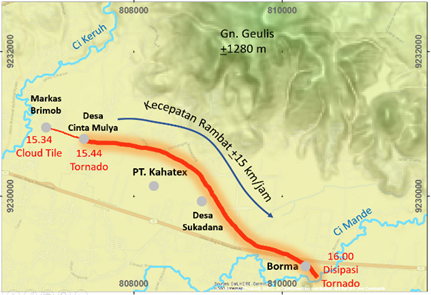
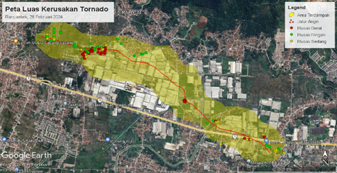
Survey results indicate that a tornado vortex occurred around 15:30 in the Rancaekek area, tracing a path approximately 4 km long and moving at an estimated speed of 15 km/h. The vortex remained active for roughly 30 minutes. The survey estimates that damage occurred across an area of 305 hectares, with a width of approximately 516 meters. Damage ranged from roofs being torn off buildings to uprooted trees. Satellite imagery from Himawari-9 shows that at 09:00 WIB, clouds covered the entire Bandung region; by 12:00 WIB, the Bandung Basin—particularly the East Bandung area—was relatively clear of clouds until 14:00 WIB. However, cloud formation began in the following hour. These were cumulonimbus clouds that developed rapidly, reaching the tropopause at 15:50 WIB and beginning to dissipate after 18:00 WIB.
A notable aspect of the webinar was the effort to explain the tornado phenomenon in greater depth. Given the limited data available, simulations were conducted to better understand the mechanisms behind tornado formation. It is hypothesized that the atmospheric vortex arose from air currents moving at different speeds within the area, creating wind shear. This generated the swirling air current—or vortex—identified as a tornado. In this context, it is important to note that while the terms puting beliung and “tornado” are often used interchangeably, the phenomenon is more accurately classified as a tornado, whereas a puting beliung is essentially a small tornado. This in-depth explanation of tornado formation mechanisms and the distinction between tornadoes and puting beliung was a highlight of the webinar.
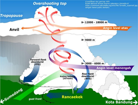
This webinar not only provides new knowledge about tornadoes but also encourages us to care more about our surrounding environment. With a better understanding of this natural phenomenon, it is hoped that we will be better prepared to face and appropriately respond to similar events in the future.